Fethard Settlement Plan 2017
Fethard Local Area Plan 2011 - Tipp Sr. Co. Co.
1.4.2 National Development Plan 2007-2013
The National Development Plan (NDP) identifies investment funding for significant projects in sectors such as health services, social housing, education, roads, public transport, rural development, industry, and water and waste services. The NDP is designed to strengthen and improve the international competitiveness of the Country so as to support continued, but more balanced, economic and social development in line with the NSS.
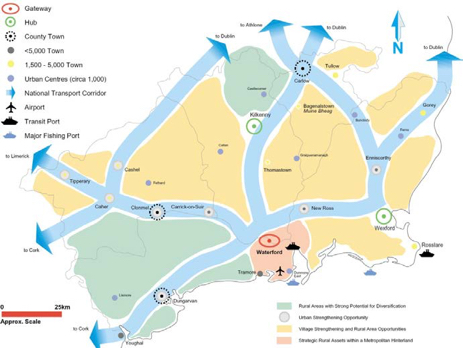
Fethard is located north of Clonmel (14km) and southeast of Cashel (14km) and the M8 Motorway at the intersection of the Regional Roads R689 and R692. It is overlooked by Sliabh na mBan (6km South East) and Market Hill (1km South).
Fethard sits in a fertile agricultural plain at a crossing place on the River Clashawley, is a local shopping and business centre and is central to the thoroughbred horse industry.
The town is distinguished by the almost complete medieval town defences that enclose the historic town core containing medieval castles, churches and buildings.
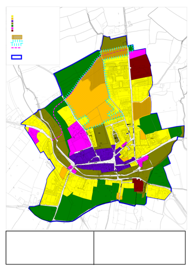
: Land Use Zoning Map No. 1: Land Use Zoning
69.4 New Residential- Low Densiy/Serviced Sites
80.7
Town Centre
Amenity
Green - Agriculture
Social and Public Industrial / Employment
The population of Fethard in 2010 is approx. 1570
The Council have selected a population growth range of between 220-280 persons over the lifetime of this LAP as a likely growth scenario for Fethard. This would see the potential population in Fethard grow to between 1790 and 1850 in 2016.
The results of Census 2006 illustrates that the main occupations among the workforce of Fethard are Manufacturing, Building and Construction and Services with Manufacturing accounting for the highest employment threshold. The occupation sectors of Professional, Technical & Health, Sales & Commerce and Clerical, Management & Government also account for high occupation thresholds. Comparative analysis with 2002 Census figures show a similar employment distribution although numbers employed in Building and Construction declined between 2002-2006.
![]()

The GSI Soils map (2006) is set out below for Fethard.
The red area represents that area where alluvial soils have been historically deposited. Alluvial soil mapping alone is not a definitive gauge of areas at flood risk, however, it a useful indicator of areas where flood events have occurred historically.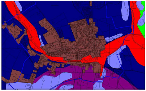
Policy TC 3: Opportunity Sites
It is the policy of the Council to facilitate the restoration, re-use and/or redevelopment of the Opportunity Sites in accordance with the development briefs outlined in this plan.
3.2.2 Public Realm Improvements
These initiatives form the basis for the LAP’s policy for public realm enhancement and include
- Reducing dominance of parking on Main St. and develop a pedestrian friendly realm.
- Reinstate the old market square at the east end of Main St.
- Improved paving, planting, lighting and provision of street furniture.
- Develop the Tholsel as a focal building, widen footpaths outside same and connect with the old market square through public realm improvements.
- Enhancement of medieval laneways, in particular Chapel Lane.
- Develop a frontage programme to improve buildings on Main St and Burke St.
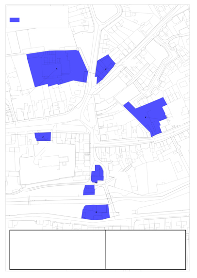
Zoning:
Heritage Designations:
-Within zone of archaeological potential.
Zoning:
Heritage Designations:
-Within zone of archaeological potential.
Amenity and community uses.
Zoning:
Heritage Designations:
Town Centre and New residential.
Zoning:
Heritage Designations:
Town Centre.
-Within zone of archaeological potential.
Zoning:
Heritage Designations:
-Within zone of archaeological potential. -NIAH Reg. 22110021. Regional Rating of Importance.
